While the first section of our road trip north was one of discovery, the second section was focused on re-discovery.
My wife spent most of her youth in San Luis Obispo, down near where we started our northbound trek, but I grew up near San Francisco, as a fourth-generation resident of Marin County. I was born in San Rafael (the heart of “I Want It All Now” country), and received most of my education in Marin and San Francisco. My wife and I met in Marin, backstage at the ballet company where we both danced, and I courted her on from sides of the Golden Gate Bridge.
Since our wedding, though, we hadn’t spent any time in San Francisco, other than to pass through en route to see family. Thus, as part of this just-for-us quasi-top-drawer road trip, a few days spent in our old stomping grounds was a must. It was in scheduling this stay that I learned that my wife had never taken a ride on a cable car. You know how it is; you never do the touristy things in your own town, right? Well, now we were the tourists, and I was going to make damned sure she got her cable car ride.
The Approach

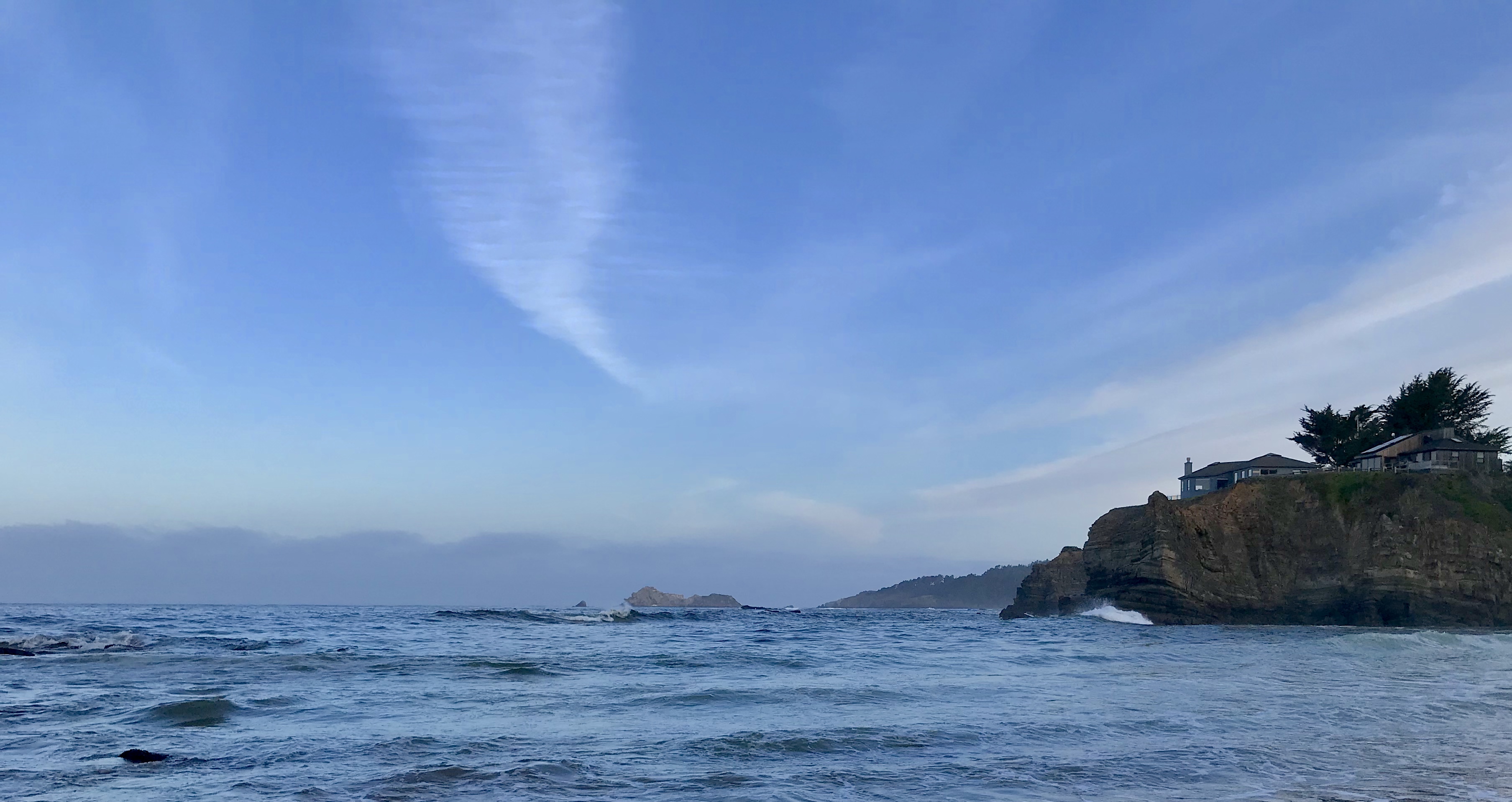
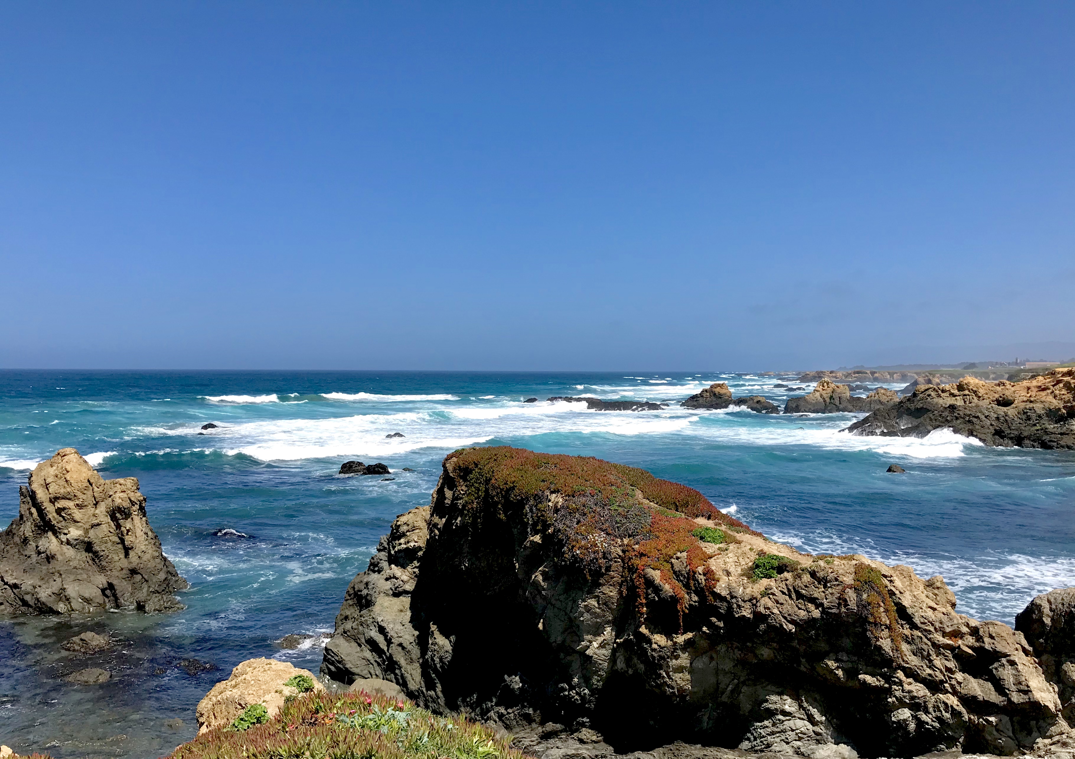
The road from Monterey to San Francisco passes through several towns and cities as one approaches the megalopolis—Rio Del Mar, Santa Cruz, Pescadero, Half Moon Bay—and it’s a section of Highway 1 that I’ve rarely traveled. The road meanders inland here and there, but generally sticks close to the shore, and it’s a decidedly beautiful section of the coast, too, with a mixture of sandy beaches for surfers and and rocky shores for seals, waterfowl, and tidepool wanderers. We had passed several lighthouses and stations so far on our trip, but the one at Pigeon Point was particularly lovely (though sadly, not open to the public when we passed by).
Despite their increasing proximity to SF, every burg on the southern approach still had that “beach town” vibe. There was salt in the air, sand on the sidewalks, and a decidedly hippie-ambiance that permeated everything close to the shore. The latter was on display nowhere more distinctly than at The Barn, a great little eatery set in, well, in a barn, in the sleepy country-home-for-the-rich town of Half Moon Bay. As purveyors of “Love, Peace, & Burger Grease,” this isn’t your typical hippie setup, and it’s decidedly more efficient than anything the old “drop in, drop out, turn on” crew of my generation could manage, but they have the whole sustainable, locavore, farm-to-table thing going, and in spades. The service was excellent, the music was eclectic, the energy was positively vibrant, and the food was as if your favorite childhood drive-in had grown up and decided it wanted to learn how to really cook: delicious, hearty, old-school favorites made with modern, high-quality ingredients. I’m talking burgers, chili dogs, and mac-n-cheese, here. If you’re ever within fifty miles of the place, go; you won’t regret it.
After Half Moon Bay, The City started to present itself. The monoculture of suburban sprawl began to crowd in on either side, and the heretofore two-lane Highway 1 spread out to four lanes of divided freeway, as if trying to keep up with its surrounds. Green directional signs leaned out over the road, and the shoreline grew distant, hidden behind the ranks of ever-taller, ever-closer buildings. Linda Mar, Pacifica, and Daly City blew past, and Highway 1 got lost in the jumble of I-280. I recognized nothing—a lot changes in a quarter century—but once we passed San Francisco State University, where I spent my first college years, I began to recover my bearings.
A Hidden Gem
My relationship with San Francisco had always been somewhat unusual, in that I didn’t spend much time in the central places that usually come to mind: Downtown, the Financial District, the Mission, the Haight, Fisherman’s Wharf. Instead, the city I knew was of two extremes: on the bay side, the Embarcadero, the Opera House, and the Marina, and on the ocean side, the Presidio, the Park, and (my favorite) the Sunset District.
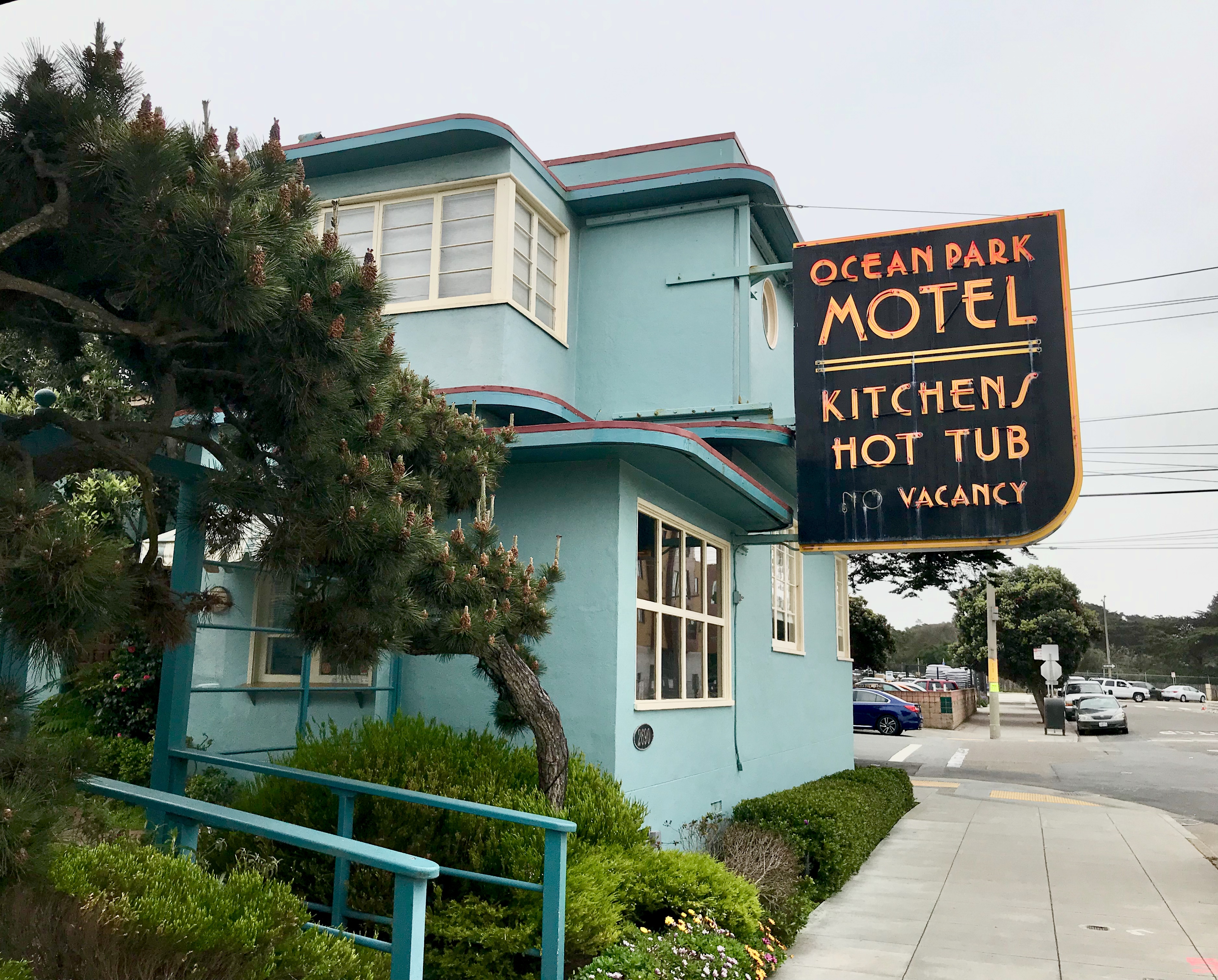
The Sunset is on the west side of town, the ocean side. It’s a lovely residential area, arranged in a grid of numbered avenues (from 2nd near midtown to 48th along the beach) and alphabetized streets (from Anza near the Presidio to Yorba down by the zoo). If you followed that, then when I tell you that the place we stayed was at 46th and Wawona, you’ll know we were way off the beaten path, about as far from tourist meccas like Fisherman’s Wharf and Ghirardelli Square as you can get.
 But what a place we found!
Ocean Park Motel was the first motel ever built in San Francisco. Ever. Constructed in 1936, it opened the following year. What many thought was destined to be a failure (J. Edgar Hoover denounced motels as “dens of iniquity) instead became a huge success as its opening coincided with the extension of the ‘L’ train that brought folks out to picnic at Fleishhacker Zoo or enjoy the arcades and rides at Playland-at-the-Beach. The motel has been in business ever since, and I have to tell you, it is a trip back in time.
The motel’s stucco-clad Art Deco style is still strongly visible, though renovations have toned down the original nautical theme. The rooms are pretty much as they were in the ’30s (which means small, by current standards), with casement windows, upflow heater vents in the floor, and old school pedestal sinks in the squeeze-into bathrooms. The cypresses planted when the building was new are still there, albeit a good bit taller now, and the place sports a luscious green garden courtyard, an adjunct garden with swings and such for the kids, and a Jacuzzi hot tub for the grown-ups. We had booked a double-room, and upgraded to a suite with a full kitchen (still cheaper than our night in Monterey), and it was like stepping onto a movie set. In the evening, when the fog rolled in, we put Rosemary Clooney on Spotify, listened to the foghorns out on the beachhead, felt the rumble of the ‘L’ train as it made the loop for its return trip, and, were I to look out the window, I was sure I would see Sam Spade amble past, fedora brim down and trench collar up.
Going Full Tourist
The next day—our full day in The City—we set out to rectify my wife’s bucket list deficit. I’d purchased a pair of all-day “Passport” passes that allowed us to ride any Muni bus, train, or car. At $12, it’s a lot cheaper than either an Uber or parking our car. I’m a fan of taking public transport when visiting a city; it gives you a unique perspective of the town and its residents that you just don’t get in a cab or driving yourself around.
We caught the ‘L’ train (an electric streetcar, really) that took us up through the avenues and into the tunnel that goes under the hills of Twin Peaks. Now, when I was last a regular Muni rider, the tracks resurfaced in the Castro District, but as I said, things change in twenty-five years, and after a while my wife asked, “How long does this tunnel go on?” As Church Street blew past, and we headed, still in the dark, toward Van Ness, I had to say the dreadful words: “I don’t know.”
Sometime during the decade or so, the streetcars along Market Street had been put underground, all the way to the Embarcadero, which pretty much trashed my theories about public transport and seeing the city through our streetcar’s windows. Ah well. Next time, we’ll grab a bus instead.
We popped up like a couple of prairie dogs at the Market and Powell station. Market and Powell is deep downtown, just a few blocks from Union Square, and is the terminus for the best cable car ride in The City. The fog that hung around Ocean Park in the morning had burned off downtown. The day had turned sunny, but the marine breeze kept it cool, which was a good thing, as the line at the cable-car turnaround was about an hour long; not bad for a splendid Sunday in April. The turnaround, for those of you unfamiliar with the process, is a big, cable-car-sized turntable at either end of the car’s route. The car rolls onto the turntable, the gripman and conductor jump down and physically spin the turntable, rotating the car 180° so it points in the other direction, and then they shove it off the turntable onto the outbound tracks where passengers may board.

We waited in the pleasant sunshine, chatting with some of our fellow queue-mates, and listened to the bass guitar and percussion duo who seemed to be figuring it out as they went along. It should be noted that the turnaround at Market and Powell is the terminus for two cable car lines: the Powell-Mason line, and the Powell-Hyde line. If you go, I recommend the Powell-Hyde line, as it’s going to give you the best sights along the way. Union Square, Coit Tower, Lombard Street, the Original Swensen’s Ice Cream (okay, that one was just for me), Alcatraz, Fisherman’s Wharf, and the Hyde Street Pier. It also takes you past the Cable Car Museum. Yes, it’s the more “touristy” line, but don’t be shy. Embrace your inner tourist.
We finally crept our way to the front of the line, demurred when a Powell-Mason car came along (as did other would-be passengers), and promptly boarded the Powell-Hyde car when it was ready. My wife took a seat, I grabbed onto the post as a hanger-on, and with a friendly cling-clang of the gripman’s bell, we were off.
Cable cars are a lovely example of a low-technology, high-reliability system. In the street, between the tracks, is a small trench in which an actual cable travels. It moves at about nine miles per hour through a long series of pulleys and wheels, all along the car’s route. The car has a grip (operated by the gripman) that latches onto the cable, which pulls the car along. On downhill stretches, the gripman releases the grip, lets gravity take over, and applies the brakes as necessary. Sit near the gripman and you’ll smell the smoke as the wooden brakes heat up against the rails. They’re made of pine and last about three days before they burn through and need to be replaced. Dead simple.
When I was studying music at SFSU, running around town to gigs and lessons and such, I used the cable cars a lot. I’d run out from the curb, viola under one arm, and hop on to get up to the Fairmont or Grace Cathedral or my teacher’s flat on Nob Hill. So much had changed since then, though, I wondered, are these only for tourists now?
And as we trundled up the long hill toward Chinatown, tourists dropped off and spaces opened up, and I was heartened to see that locals did still used the cars: a woman with her bag of groceries, a young student with his nose in his phone. Happily, these are not just anachronisms maintained for the tourist trade. They’re a useful mode of transport, and with a Muni pass, you can just hop on/hop off, like we did for free in older days.
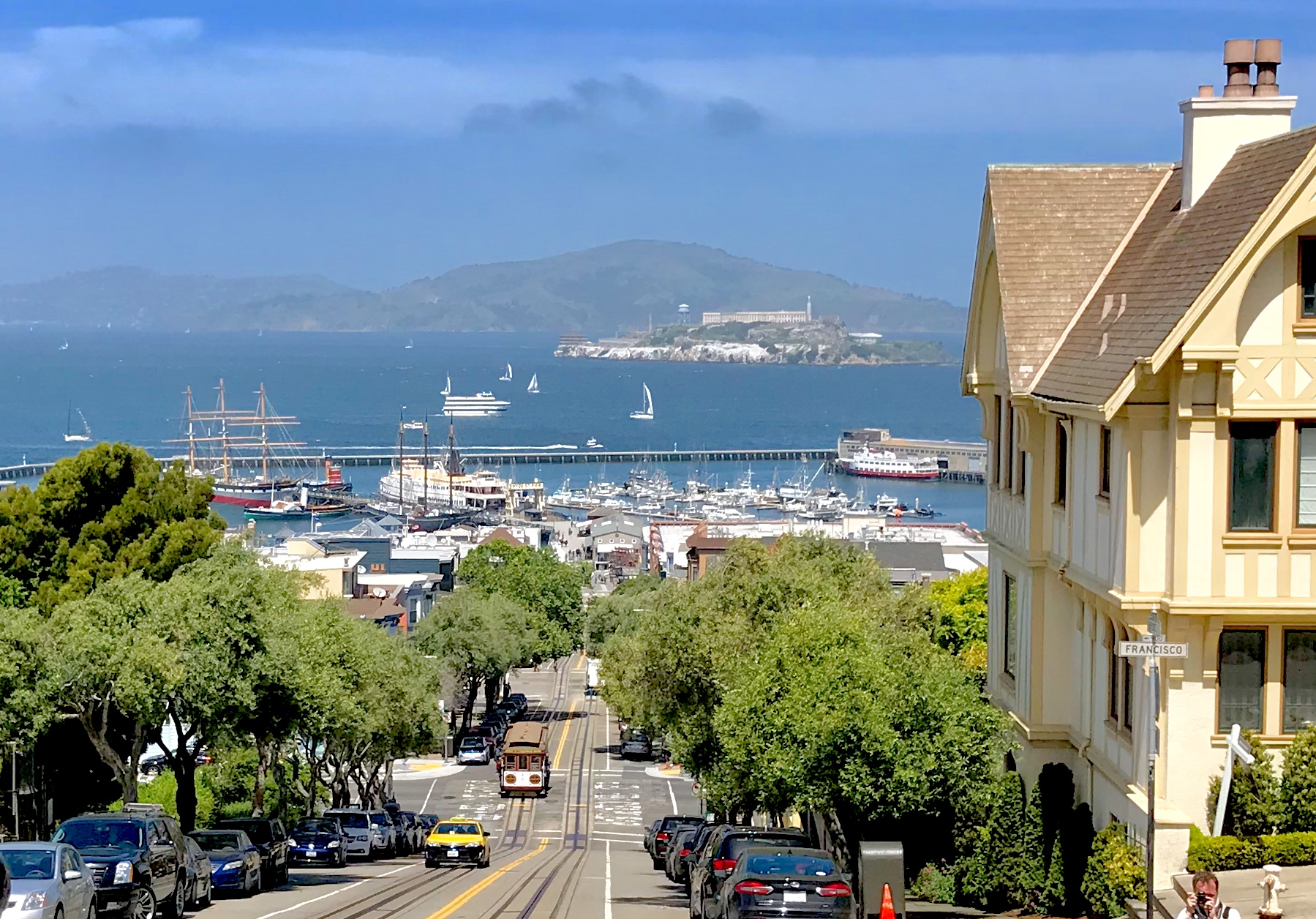
Despite all this people-watching, though, the best part for me was seeing the grin on my wife’s face as we crested the hill on Hyde Street and the bay came into view. The waters were deep blue, Alcatraz was dimmed but a little by the marine haze, and the masts and yardarms of the Balclutha and other ships moored at the Hyde Street Pier were clearly visible, evoking images of times long gone.
The Powell-Hyde line ends at the Hyde Street Pier, at Fisherman’s Wharf, within a stone’s throw of Ghirardelli Square, but we were content to have a nice Sicilian lunch and head back the way we came, back to our little suite where, supplied with bread, cheese, and wine from Phil and Mona at the local deli, we relaxed in the cool of the ocean’s breeze.
This was us. This. Coming home to enjoy a few simple pleasures after a day’s exploration of a wonderful city that will always be dear to our hearts. This was us.
And tomorrow, we knew we’d be heading to another place filled with memories of our beginnings as a couple. It was several hours farther up the coast, though. There’s no hurrying on California’s Highway 1.
More later.
k
x
x


[…] Here’s where you can find the posts on the Southbound leg, and the Northbound legs Part 1, Part 2, & Part […]
LikeLike
[…] (If you’re late to the party, no worries. Here’s where you can find the posts on the Southbound leg, and the Northbound legs Part 1 and Part 2.) […]
LikeLike